

The Aeon Herald / HISTORICAL EDITION
Television Satellite Sends Pictures of Earth’s Clouds
TIROS opens a new way to observe weather systems from above rather than from scattered stations below.
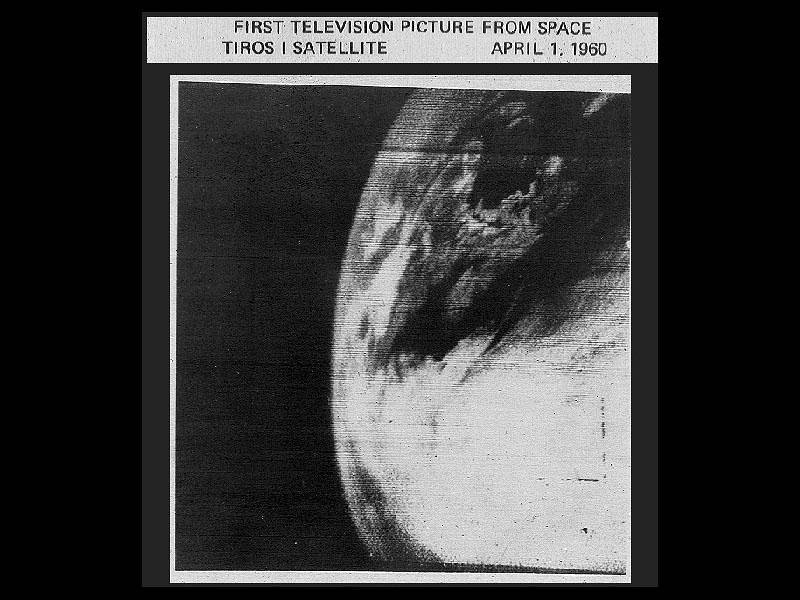
Cloud cover seen by the TIROS-1 weather satellite, April 1, 1960. NASA. Image source · NASA editorial/informational media permission; U.S. government work.
CAPE CANAVERAL, Fla., April 2.—A television weather satellite launched yesterday has begun returning pictures of the Earth's cloud cover. TIROS, whose name stands for Television Infrared Observation Satellite, carries cameras into an orbit from which weather systems can be viewed on a scale unavailable to a single observer on the ground.
The pictures are a demonstration of a new observing position, rather than a finished forecasting service. Meteorologists must learn to relate the patterns seen from space to pressure, temperature, winds and the reports gathered by ships, aircraft and land stations. Clouds can show where a system lies without supplying every measurement needed to predict its behaviour.
The experiment is especially promising over oceans, where direct observations are widely separated. A view of an entire cloud pattern may help connect reports that would otherwise remain isolated.
TIROS makes the weather itself an object of space observation. The practical question is how quickly the images can be interpreted and put to work. Yesterday's launch has given forecasters a new instrument; experience must teach them its proper use.
Sources & further reading
- Celebrating the World’s First Meteorological Satellite: TIROS-1 — NOAA / NESDIS.
- First Photo of Earth From a Weather Satellite, TIROS-1 — NASA, 2009-04-02.
- TIROS-1-Earth.png: file metadata and rights — NASA / Wikimedia Commons.
Related Herald reporting
- Explorer Reaches Orbit; United States Launches Satellite — Donald Price, 1958-02-01.
- Soviet Satellite Circles Earth; Radio Signal Heard — Paul Norton, 1957-10-05.