

The Aeon Herald / HISTORICAL EDITION
Witch Fire Carries a Backcountry Emergency Into Rancho Bernardo
The Witch and Guejito fires joined in a wind-driven run toward San Diego. More than a thousand homes were lost across the county, including 365 city residences.
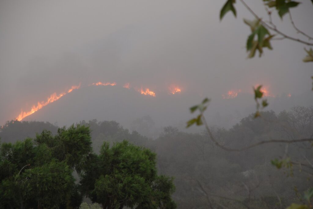
SAN DIEGO — Four years after Cedar, San Diego again faced a fire that crossed the apparent separation between the backcountry and the city. The Witch fire began east of Ramona just after noon on October 21. By about four o'clock the following morning it had reached the city. A second fire, Guejito, began in the San Pasqual Valley during those same early hours and joined the advance.
The Witch incident burned 197,990 acres. Two civilians died, and more than a thousand residences were destroyed across the county. Within San Diego, all 365 residences destroyed by the Witch-Guejito fires were in Rancho Bernardo. The concentration of those city losses gives a more precise account of the disaster than the broad perimeter alone: an immense backcountry fire produced a particularly severe urban wound.
The scale of evacuation was equally striking. More than half a million people lived in the areas placed under evacuation, including roughly 200,000 within the city. Those figures describe the population of the affected zones, rather than a count of people who actually left. Even with that qualification, they show how far the work extended beyond the streets on which houses burned.
Qualcomm Stadium became a major shelter, receiving evacuees, volunteers, donations and animals. A separate site at Fiesta Island accommodated horses and other large animals. The arrangements show another side of a fire operation: households need somewhere to go while crews defend the places they have left. By noon October 26, the evacuees at Qualcomm had returned home, made other arrangements or moved to the county shelter at the Del Mar Fairgrounds.
The Santa Ana winds carried the fire westward from the inland hills. Canyons helped direct that flow through rough terrain. By October 25, the winds had moderated enough to improve conditions for firefighters, but a NASA satellite image that day showed how much remained unresolved. The incident was then only thirty percent contained, despite the apparent improvement in the weather.
The image used infrared observations to distinguish active burning from the surrounding ground. Near Ramona, a burned mountain slope exposed the rugged land beneath the vegetation. Farther west, actively burning areas appeared on both sides of Interstate 15. The highway was an important line on the transportation map; the observations showed that the incident was operating across it, rather than politely ending at its edge.
Other details in that image require care. Dry natural vegetation appeared green in the processed view, while irrigated lawns looked brighter. Those colors were not an ordinary aerial photograph of healthy and unhealthy plants. They were a way of displaying different wavelengths of light. For people trying to understand a fast-moving emergency from television pictures and published maps, the distinction between a picture's appearance and its meaning mattered.
By November 6, the state incident record listed full containment. Recovery will proceed at a different pace in different places. A household whose home remains standing may still have spent days away; a household in a burned Rancho Bernardo block faces a much longer interruption. Countywide and city-only figures should therefore remain distinct. They describe overlapping responsibilities and different dimensions of the same event.
The Witch fire's passage was measured in miles, but its most urgent intervals were measured in hours. The Ramona start, the overnight Guejito ignition and the arrival at San Diego followed one another before a normal working day had begun. The completed perimeter now offers a fixed outline. What it records is a disaster whose boundaries were moving while communities were still trying to determine how to get clear of them.

Sources & further reading
- Witch Fire incident record — CAL FIRE.
- 2007 Witch Creek and Guejito Fires — City of San Diego Fire-Rescue.
- Witch Fire — NASA Earth Observatory; image courtesy of Lawrence Ong, 2007-10-27.
- October 2007 Wildfires After Action Report — City of San Diego, 2008-02.
Related Herald reporting
- Catalina’s Fire Scar Leaves a Long Recovery Beyond Avalon — Jennifer Dalton, 2007-11-12.
- Station Fire’s Smoke Spreads Beyond the Flames in Satellite View — Andre Lawson, 2009-09-02.
- Station Fire Leaves the Angeles Forest With a Long Recovery — Jennifer Dalton, 2009-10-25.
- Old Fire Leaves a Burned Route From Valley to Mountain — Jennifer Dalton, 2003-11-23.
- Cedar Fire Crosses the Distance Between Forest and City — Jennifer Dalton, 2003-11-16.
- Thomas Fire Ends With a Second Disaster in Its Watershed — Jennifer Dalton, 2018-01-21.
- Camp Fire Search Revises the Toll as Paradise Faces Its Ruins — Jennifer Dalton, 2018-12-05.
- Woolsey Fire Leaves Homes and a Piece of the Movies to Rebuild — Jennifer Dalton, 2019-01-13.
- Bobcat Fire Burns a Route Across the San Gabriels — Jennifer Dalton, 2020-12-27.
- Palisades Fire Contained Without the Loss of a Home — Jennifer Dalton, 2021-05-27.
- Dixie Fire Burns Through Greenville as Smoke Spreads Across the West — Jennifer Dalton, 2021-08-08.
- Old Topanga Fire Tested Every Route Between the Canyons and the Coast — Gary Preston, 1993-11-14.
- Laguna Beach Reckons With a Fire That Reached the Houses — Gary Preston, 1993-11-14.
- McKinney Crews Turn to Repair After Fire Devastates Klamath River — Jennifer Dalton, 2022-08-30.
- Mosquito Fire Leaves Waterworks and Burned Homes in the Repair Account — Jennifer Dalton, 2022-10-24.
- Post Fire Leaves Hungry Valley Closed for a Different Kind of Recovery — Jennifer Dalton, 2024-07-04.
- Park Fire Leaves a 429,603-Acre Scar as Emergency Managers Count the Disruption — Jennifer Dalton, 2024-09-25.
- Eaton Fire Containment Leaves Altadena Facing a Long Recovery — Jennifer Dalton, 2025-02-01.