

The Aeon Herald / HISTORICAL EDITION
Thomas Fire Ends With a Second Disaster in Its Watershed
After nearly forty days and 281,893 burned acres, Thomas is contained. The deadly January 9 debris flows make clear that the fire perimeter did not define the limits of the emergency.
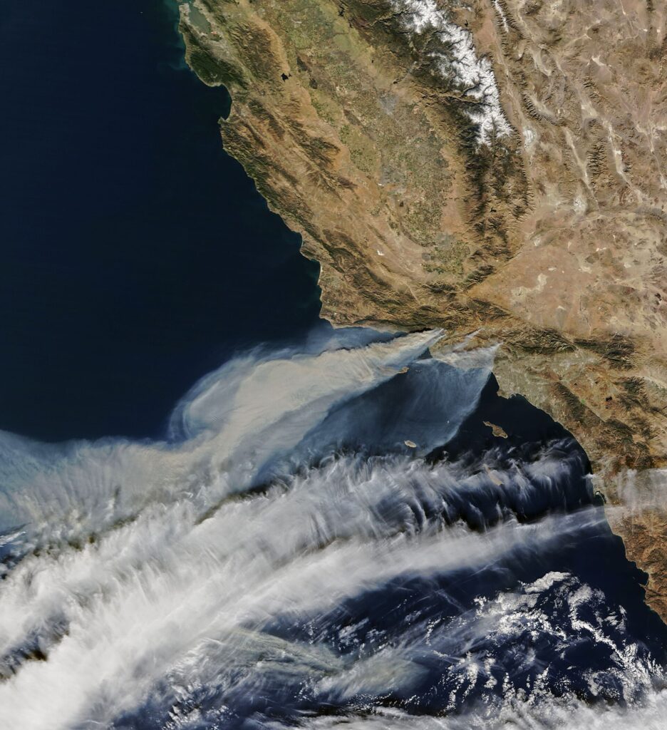
VENTURA — The Thomas fire's containment on January 12 closed an exceptionally long firefighting operation. It did not close the disaster. Three days earlier, intense rain on the burned slopes above Montecito had sent deadly debris flows into developed areas below. The transition from fire to flood occurred before crews had finished securing the fire's outer boundary.
Thomas burned 281,893 acres in Ventura and Santa Barbara counties. More than a thousand structures were destroyed. The fire itself killed one civilian and one firefighter, losses that must be recorded separately from the victims of the subsequent debris flows. The incidents are physically connected through the burned watershed, but their death tolls are different accounts of different events.
The fire began on the evening of December 4 north of Santa Paula, near highways 150 and 126. Its advance threatened Santa Paula and Ventura, then the country around Ojai and communities farther west. The emergency eventually extended toward Summerland, Montecito and Santa Barbara. Nearly forty days separated the start from full containment, carrying the operation through the holidays and into a new year.
December is ordinarily part of California's wet season. The conditions preceding Thomas supplied a particularly unfavorable combination: an unusually wet winter and spring had encouraged vegetation, followed by an exceptionally dry summer and autumn. Rain remained scarce into November and December. Growth that had flourished earlier in the year was available to burn when hot, dry winds arrived.
That sequence complicates the ordinary contrast between a wet year and a dangerous fire year. Water had helped produce vegetation; the long interval without meaningful rain dried it. Strong Santa Ana winds then accelerated the spread. The result was a December fire whose size exceeded the 273,246 acres burned by San Diego County's Cedar fire in 2003.
A December 18 Landsat view showed the burned hills around Ventura, Ojai and Oak View and the advance toward the Santa Barbara coast. The image combined the satellite's view with elevation information, making the relationship between the scar and the mountains visible. It is a landscape in which the ground above a community cannot be treated as a separate place simply because it lies outside the developed streets.
At the height of the emergency, more than 8,500 firefighters were mobilized. The great scale of that deployment reflected a fire crossing jurisdictions and threatening several communities over an extended period. It also meant that the incident continued to demand resources after any single town's immediate danger had eased. A quieter day in one district was only part of the wider operation.
The January 9 rain demonstrated another connection between higher ground and the coast. Runoff moved sediment and large material down slopes altered by the fire. In Montecito, the result was a second destructive emergency, carried by water rather than advancing flames. The danger came from what remained above the community as much as from the ground upon which its buildings stood.
For recovery work, that distinction is unavoidable. Clearing a road, assessing a house and examining a burned drainage are separate assignments, but one can determine whether the others remain useful. A street reopened to ordinary traffic can still lie beneath a damaged watershed. The end of the firefighting operation supplies an important date for the record; it cannot by itself settle the condition of every slope or drainage below the perimeter.
The Thomas fire has joined places more often considered as separate communities into a single recovery landscape. Its chronology now runs from a December evening near Santa Paula to a January morning in Montecito, through fire, containment work and rain. The acreage can be stated in one line. Understanding the disaster requires following the water as well as the flames.

Sources & further reading
- Thomas Fire incident record — CAL FIRE.
- Ventura County Fire Department Investigators Determine the Cause of the Thomas Fire — Ventura County Fire Department, 2019-03-13.
- California’s December Inferno — Adam Voiland, NASA Earth Observatory, 2017-12-21.
- Devastation from California’s Largest Wildfire Seen in New NASA Satellite Image, PIA22189 — NASA / U.S.–Japan ASTER Science Team, 2018-01-05.
- Mudslide Incident Report, January 19, 2018 — Montecito Water District, 2018-01-19.
- Inundation, Flow Dynamics, and Damage in the 9 January 2018 Montecito Debris-Flow Event — Jason W. Kean and colleagues, U.S. Geological Survey / Geosphere, 2019-06-07.
Related Herald reporting
- Camp Fire Search Revises the Toll as Paradise Faces Its Ruins — Jennifer Dalton, 2018-12-05.
- Woolsey Fire Leaves Homes and a Piece of the Movies to Rebuild — Jennifer Dalton, 2019-01-13.
- Bobcat Fire Burns a Route Across the San Gabriels — Jennifer Dalton, 2020-12-27.
- Palisades Fire Contained Without the Loss of a Home — Jennifer Dalton, 2021-05-27.
- Dixie Fire Burns Through Greenville as Smoke Spreads Across the West — Jennifer Dalton, 2021-08-08.
- McKinney Crews Turn to Repair After Fire Devastates Klamath River — Jennifer Dalton, 2022-08-30.
- Mosquito Fire Leaves Waterworks and Burned Homes in the Repair Account — Jennifer Dalton, 2022-10-24.
- Post Fire Leaves Hungry Valley Closed for a Different Kind of Recovery — Jennifer Dalton, 2024-07-04.
- Park Fire Leaves a 429,603-Acre Scar as Emergency Managers Count the Disruption — Jennifer Dalton, 2024-09-25.
- Eaton Fire Containment Leaves Altadena Facing a Long Recovery — Jennifer Dalton, 2025-02-01.
- Eaton Fire Recovery Reaches From Burned Lots to Classrooms — Jennifer Dalton, 2025-08-03.
- Palisades Fire Leaves a Neighborhood and Its Public Landscape to Rebuild — Jennifer Dalton, 2025-08-03.
- Station Fire Leaves the Angeles Forest With a Long Recovery — Jennifer Dalton, 2009-10-25.
- Station Fire’s Smoke Spreads Beyond the Flames in Satellite View — Andre Lawson, 2009-09-02.
- Catalina’s Fire Scar Leaves a Long Recovery Beyond Avalon — Jennifer Dalton, 2007-11-12.
- Witch Fire Carries a Backcountry Emergency Into Rancho Bernardo — Jennifer Dalton, 2007-11-11.
- Old Fire Leaves a Burned Route From Valley to Mountain — Jennifer Dalton, 2003-11-23.
- Cedar Fire Crosses the Distance Between Forest and City — Jennifer Dalton, 2003-11-16.