

The Aeon Herald / HISTORICAL EDITION
An Orbital Image Places Los Angeles Between Coast and Mountains
A processed ASTER view brings the city’s street grid, shoreline and mountain boundary into a single frame.
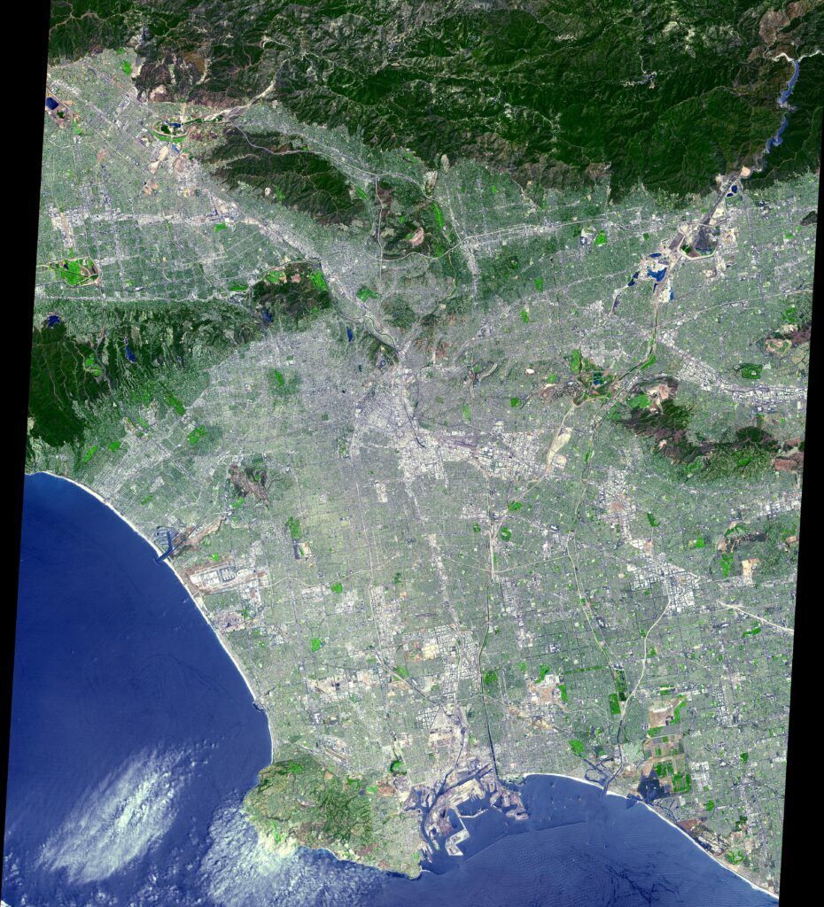
LOS ANGELES, Sept. 5 — A newly published satellite view places the Los Angeles basin, its coastal edge and the mountains to the north in one image, exchanging the street photographer’s viewpoint for a regional one.
The data were acquired July 23 by ASTER, the Advanced Spaceborne Thermal Emission and Reflection Radiometer aboard NASA’s Terra satellite. The published image covers roughly 64 by 72 kilometers and has been processed to simulate natural color.
The distinction between acquisition and publication matters. This is a July view released afterward, not a live picture of conditions on the day it appears in the newspaper. The color is a rendering of instrument measurements rather than the unmediated result of a conventional color-film exposure.
The dense street pattern can be read against the less regular terrain beyond it. Coastline and mountains provide a scale that individual road photographs seldom contain. One frame cannot, however, establish how quickly a neighborhood is changing or explain the circumstances of the people below.
ASTER was built in Japan, and a joint United States–Japan science team works on its data. The image is credited to NASA/GSFC/METI/ERSDAC/JAROS and the U.S./Japan ASTER Science Team.
Join the conversation