

The Aeon Herald / HISTORICAL EDITION
Bobcat Fire Burns a Route Across the San Gabriels
Beginning during extreme September heat, Bobcat threatened the foothills and Mount Wilson before pushing north toward Antelope Valley homes. More than 115,000 acres burned.
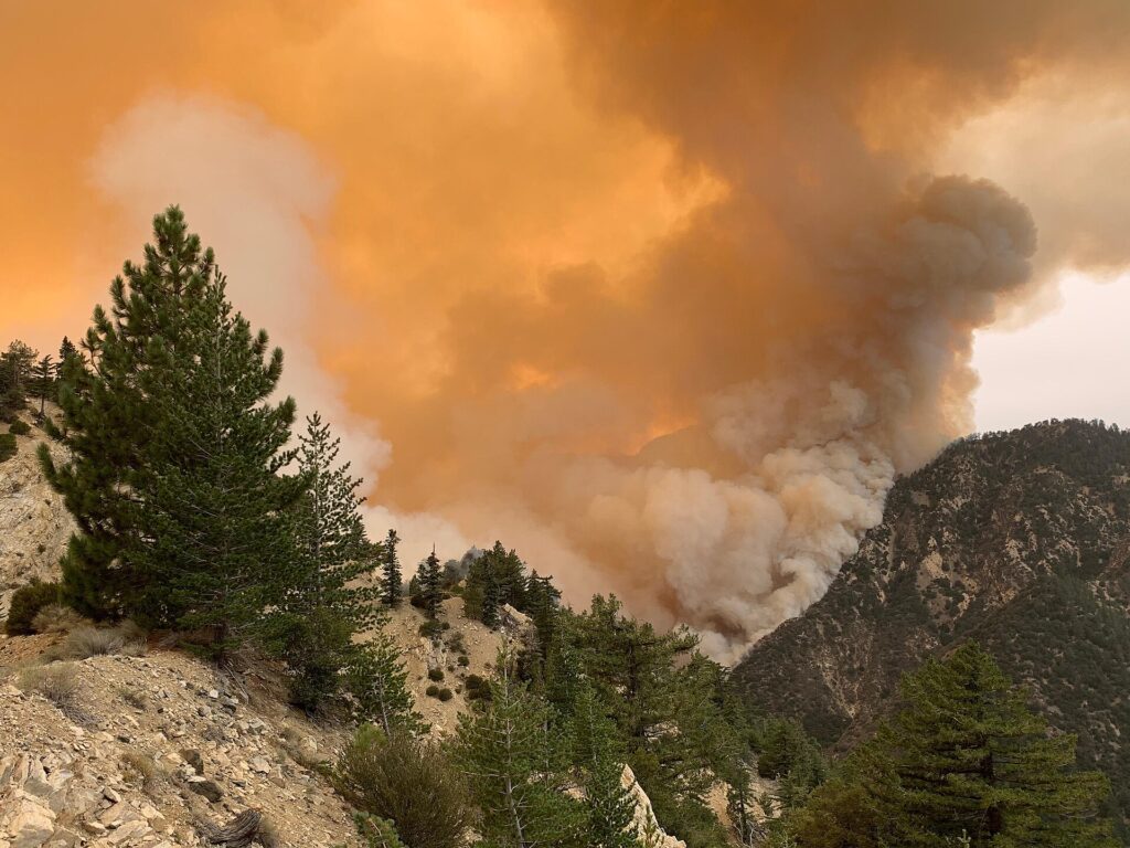
MONROVIA — The Bobcat fire's route crossed the San Gabriel Mountains during a period of exceptional heat and dryness. Winds shifted as the fire developed, carrying danger toward communities on different sides of the range and sustaining an emergency that eventually burned more than 115,000 acres.
The fire began September 6 near Cogswell Dam in the Angeles National Forest. Its early movement threatened the southern foothills, bringing evacuation activity and warnings across communities including Monrovia, Bradbury, Duarte and Sierra Madre. It subsequently threatened Mount Wilson, then expanded north into the mountains above the Antelope Valley. The same incident could require attention on opposite sides of the range as its direction changed.
Mount Wilson required sustained protection as the fire approached in mid-September. Its observatory escaped serious damage, preserving a scientific site whose position on the mountain also exposed it to the approaching flames. The successful defense of that particular location did not settle the wider incident. On September 17 and 18, the fire's movement toward the northern foothills brought a new set of homes into danger.
Juniper Hills and the Littlerock area suffered damaged and destroyed houses. Their inclusion in the fire's course is essential to understanding its extent. Bobcat was not solely a blaze hanging above the populous southern side of the mountains. It also crossed rough country toward communities facing the Antelope Valley, where the pattern of roads and development presented a different setting for the same emergency.
NASA examined the fire from two very different heights. Landsat observations mapped active burning, scarred land and intact vegetation. On September 17, an ER-2 aircraft flew above the incident at approximately 65,000 feet, carrying an imaging spectrometer. The instrument collected information about temperatures, vegetation water content, smoke and the severity of burning. Such measurements can distinguish conditions that a single smoke photograph cannot resolve.
That distinction matters for the assessment now following containment. A broad perimeter includes ground affected in different ways. The damage at a house, the condition of a mountainside and the survival of a particular facility cannot be read from acreage alone. The aerial work supplies part of the evidence needed to understand what the incident has left behind, rather than treating every acre within the boundary as interchangeable.
By December, the perimeter was fully contained. The name Bobcat now identifies a fire that connected southern foothill evacuations, the defense of Mount Wilson and losses on the northern side of the range. Its course demonstrates how quickly a change in wind direction can alter which communities face a fire, even while crews remain committed to defending the previous front.
Sources & further reading
- Health and Safety Element, historical Bobcat Fire account — City of Bradbury, 2025-06.
- Bobcat Fire Scorches Southern California — NASA Earth Observatory, 2020-09-28.
- Earth Science Highlights, October 2020 — NASA Ames, 2020-10.
Related Herald reporting
- Palisades Fire Contained Without the Loss of a Home — Jennifer Dalton, 2021-05-27.
- Dixie Fire Burns Through Greenville as Smoke Spreads Across the West — Jennifer Dalton, 2021-08-08.
- McKinney Crews Turn to Repair After Fire Devastates Klamath River — Jennifer Dalton, 2022-08-30.
- Mosquito Fire Leaves Waterworks and Burned Homes in the Repair Account — Jennifer Dalton, 2022-10-24.
- Woolsey Fire Leaves Homes and a Piece of the Movies to Rebuild — Jennifer Dalton, 2019-01-13.
- Camp Fire Search Revises the Toll as Paradise Faces Its Ruins — Jennifer Dalton, 2018-12-05.
- Thomas Fire Ends With a Second Disaster in Its Watershed — Jennifer Dalton, 2018-01-21.
- Post Fire Leaves Hungry Valley Closed for a Different Kind of Recovery — Jennifer Dalton, 2024-07-04.
- Park Fire Leaves a 429,603-Acre Scar as Emergency Managers Count the Disruption — Jennifer Dalton, 2024-09-25.
- Eaton Fire Containment Leaves Altadena Facing a Long Recovery — Jennifer Dalton, 2025-02-01.
- Eaton Fire Recovery Reaches From Burned Lots to Classrooms — Jennifer Dalton, 2025-08-03.
- Palisades Fire Leaves a Neighborhood and Its Public Landscape to Rebuild — Jennifer Dalton, 2025-08-03.
- Station Fire Leaves the Angeles Forest With a Long Recovery — Jennifer Dalton, 2009-10-25.
- Station Fire’s Smoke Spreads Beyond the Flames in Satellite View — Andre Lawson, 2009-09-02.
- Catalina’s Fire Scar Leaves a Long Recovery Beyond Avalon — Jennifer Dalton, 2007-11-12.
- Witch Fire Carries a Backcountry Emergency Into Rancho Bernardo — Jennifer Dalton, 2007-11-11.
- Old Fire Leaves a Burned Route From Valley to Mountain — Jennifer Dalton, 2003-11-23.
- Cedar Fire Crosses the Distance Between Forest and City — Jennifer Dalton, 2003-11-16.