

The Aeon Herald / HERALD ORIGINAL
Tonga’s Eruption Plume Reached the Mesosphere, Satellite Study Finds
A new measurement puts the top of January’s volcanic plume about 57 kilometers high, beyond the stratosphere.
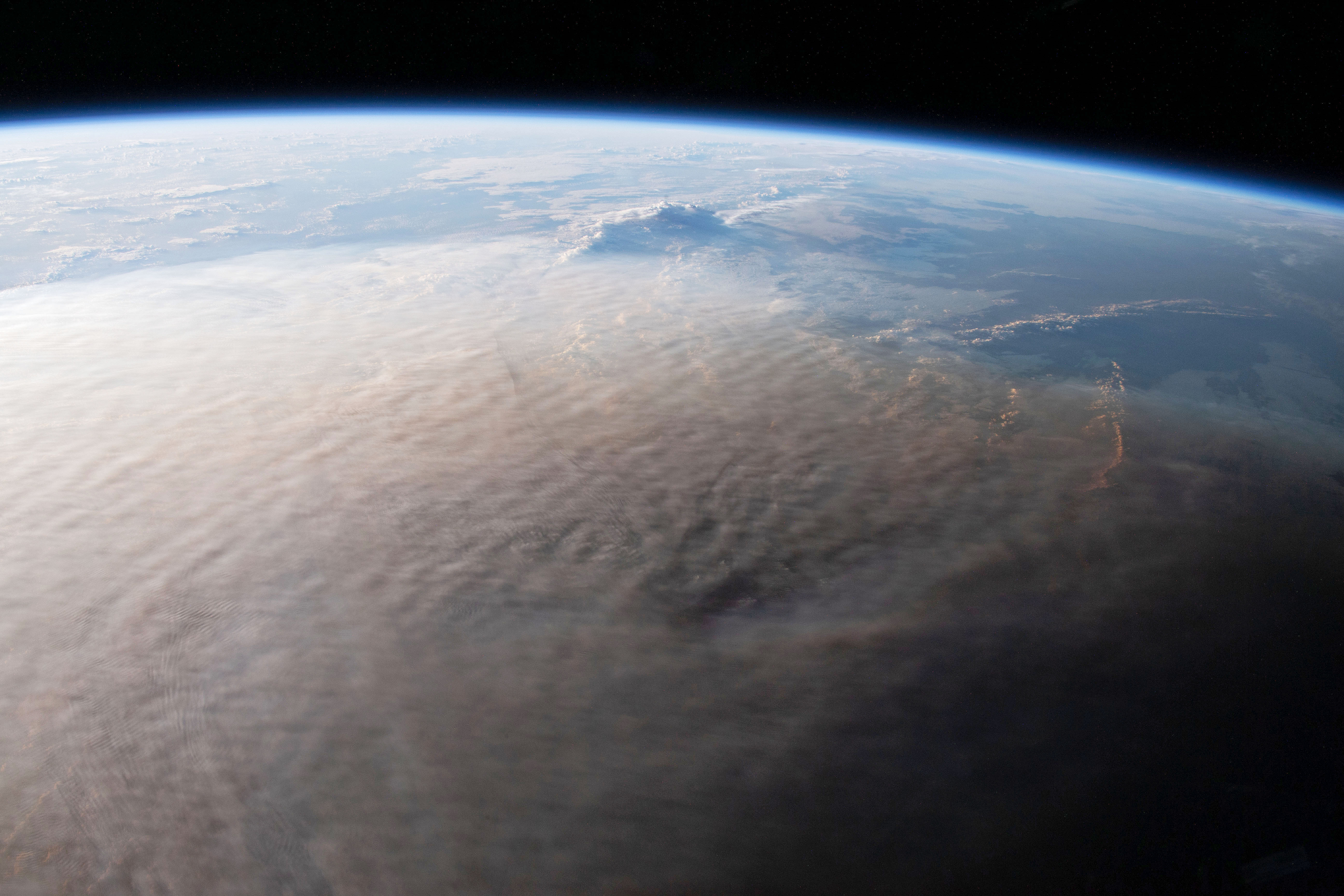
The plume above the Hunga Tonga–Hunga Haʻapai eruption, photographed from the International Space Station on January 16, 2022. NASA, ISS066-E-117965. Image source · Reuse terms.
The January eruption of Hunga Tonga-Hunga Ha’apai sent a plume about 57 kilometers above Earth, reaching the lower mesosphere, according to a new satellite analysis. The finding makes the event an exceptional test of how a powerful eruption can move material through atmospheric layers.
Simon Proud, Andrew Prata and Simeon Schmauß used images from geostationary satellites to measure the January 15 plume. Their Science paper presents observational evidence that volcanic material passed through the stratosphere and entered the region above it.
The researchers also suggest that older plume heights, including Pinatubo’s in 1991, may have been underestimated because observations were less complete. Comparisons must account for the quality of the earlier record.
The eruption had already shown how many hazards one event can produce. NOAA’s January account documented atmospheric pressure waves, sonic booms and tsunami waves, as well as ash transported by winds. Its satellite instruments also observed thousands of lightning flashes.
Geostationary spacecraft keep watch over the same broad region, allowing the rapid growth and movement of a volcanic cloud to be followed. NOAA uses satellite observations to help detect eruptions and support volcanic-ash advisories, important for aircraft as well as communities near a volcano.
The new height estimate addresses the reach of the plume, rather than providing a complete account of the tsunami or the eruption’s climatic effects. Those consequences require their own measurements. Together, the records show why an eruption beneath the ocean can remain a problem for observers well beyond the islands nearest it.
Sources & further reading
- Simon R. Proud, Andrew T. Prata and Simeon Schmauß — The January 2022 eruption of Hunga Tonga-Hunga Ha’apai volcano reached the mesosphere, November 4, 2022; 378(6619), pp. 554–557; online November 3.
- NOAA NESDIS — The Hunga Tonga-Hunga Ha’apai Eruption, a Multi-Hazard Event, January 26, 2022.
Related Herald reporting
- Kathleen Study Finds Speed and Inland Strength Behind September’s Damage — Gary Preston, 1977-03-01.
HERALD ORIGINAL
Join the conversation